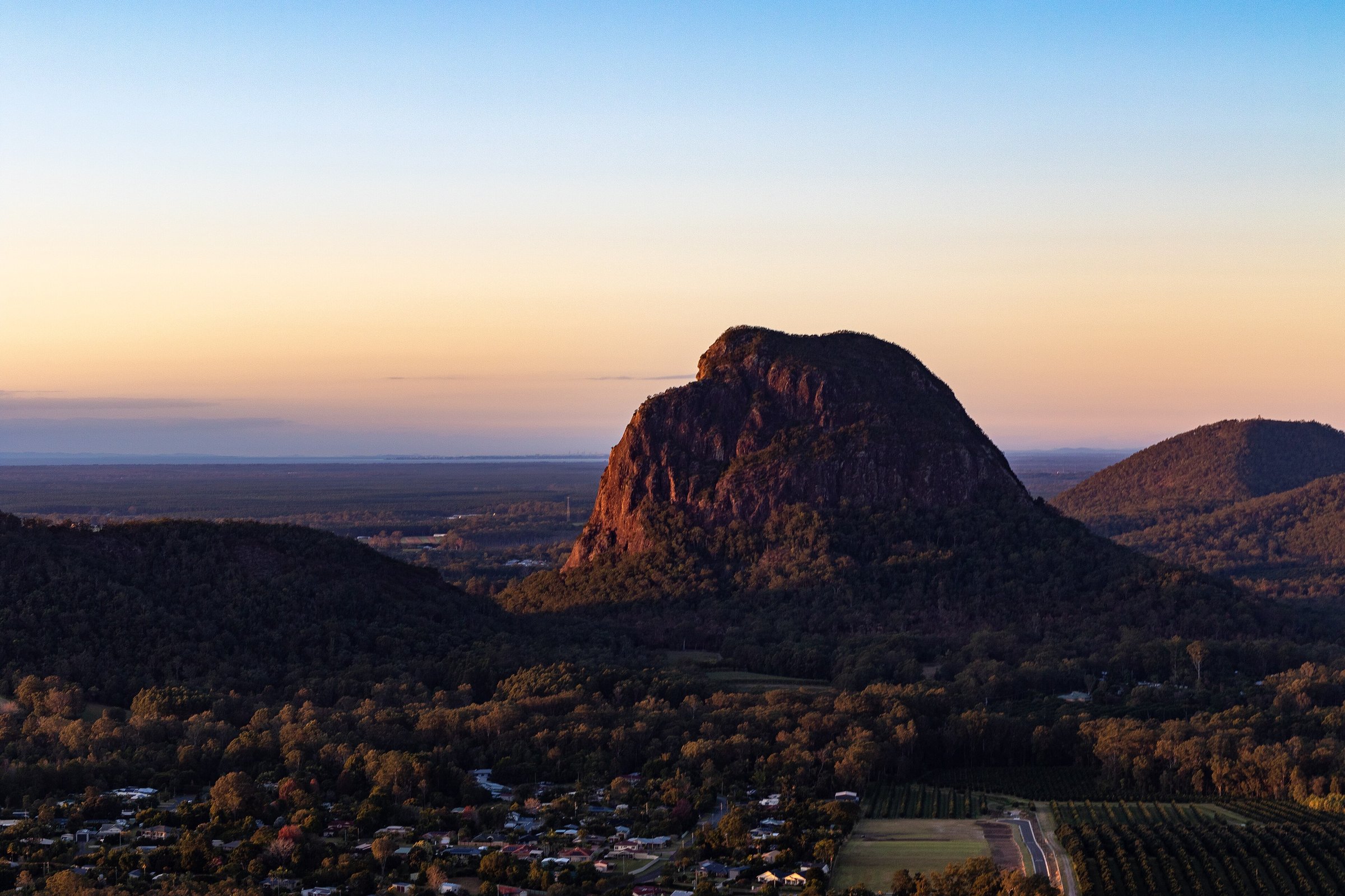
Mount Tibrogargan is a 364 m volcanic peak in Glass House Mountains National Park, about 65 minutes by car north of Brisbane, and the easiest way to get close to it is the 4.1 km Tibrogargan circuit around its base. The walk does not go to the summit, but it passes a lookout and a rest stop beneath the mountain’s big cliff face.
The summit route is a different matter: a serious climb for very fit, experienced people, on a mountain that is culturally significant to the Jinibara and Kabi Kabi peoples, who ask visitors not to climb it. This guide covers the circuit walk, what the summit route involves, and the practical details for a visit.
Tibrogargan circuit walk
The Tibrogargan circuit is a 4.1 km loop that starts and finishes at the same car park on Marshs Road. It is graded 3 (a formed track with some obstacles) with short steep sections and plenty of steps, so it suits people with some walking experience rather than a first bushwalk. Allow about 1.5 hours.
About 1 km along the loop you reach the Mountain View lookout, with views of Mount Beerwah, Mount Coonowrin, Tibberoowuccum and Tunbubudla. The rest of the track passes casuarina groves and open eucalypt and melaleuca forest, and runs beneath Tibrogargan’s cliffs. Mornings and evenings are best, when the light picks out the rock.
Sunshine Coast Council’s trail guide calls it probably the number one non-summit walk of the Glass House Mountains. It is a good first walk in the range if you want to be close to the cliffs without climbing.
Can you climb Mount Tibrogargan?
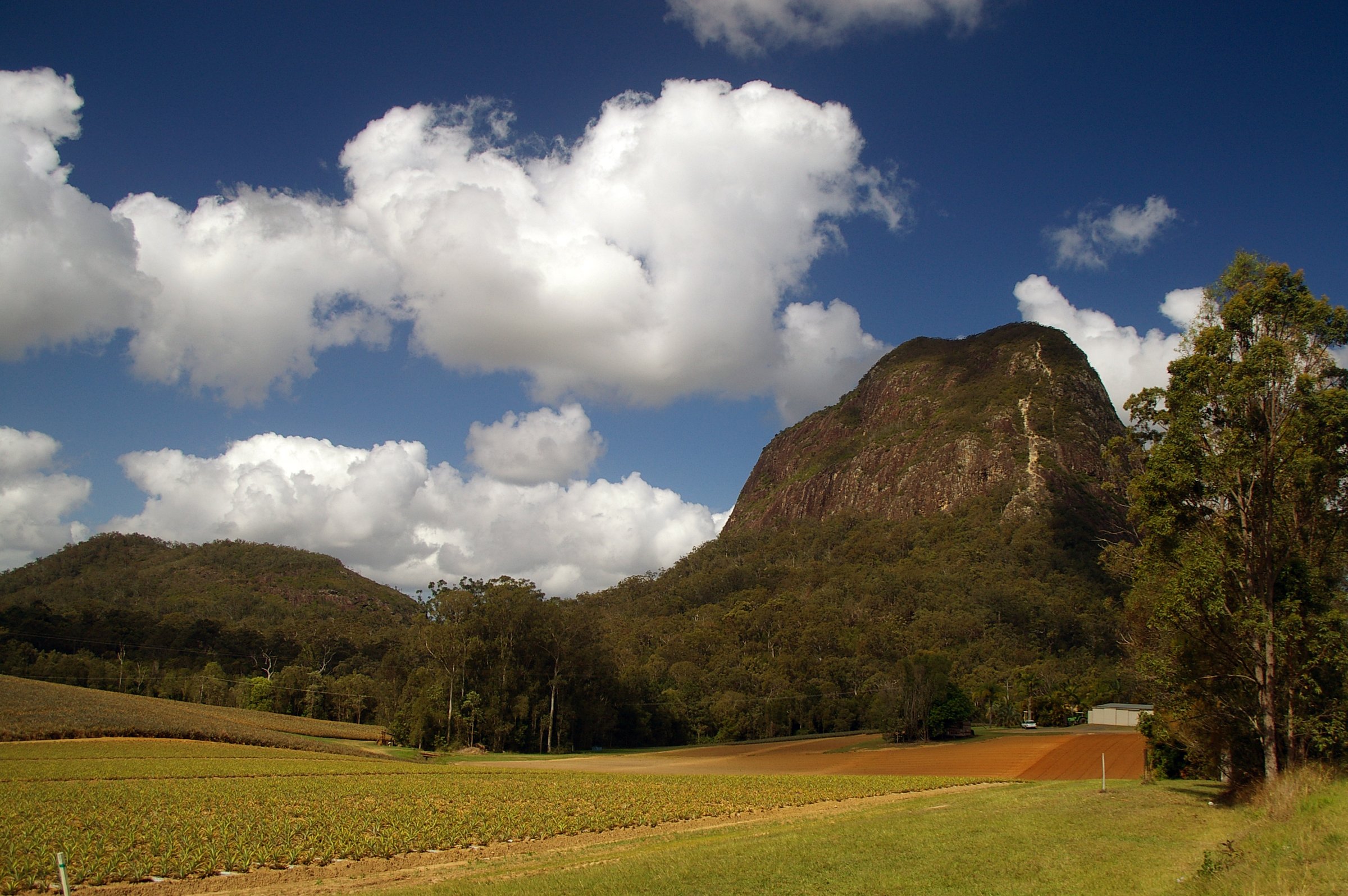
Queensland Parks describes the summit routes on Mount Beerwah and Mount Tibrogargan as extremely challenging. They are only for very fit, well-prepared climbers, with exposed rock, steep cliffs and rock scrambling, and they are not recommended for inexperienced climbers or anyone with young children.
The Jinibara and Kabi Kabi peoples consider the Glass House Mountains culturally significant and ask visitors not to climb them. In 2023, during NAIDOC Week, Queensland Parks and the Kabi Kabi people asked visitors to consider not climbing the culturally sensitive summit of Tibrogargan. The walking tracks give you views of the mountain without the climb.
Whatever you decide, tell someone your plan, start in daylight and carry more water than you think you need. In an emergency call 000.
Other places to see Mount Tibrogargan
- Glass House Mountains lookout: a drive-up lookout with views across the range, covered in our Glass House Mountains guide.
- Mount Ngungun summit walk: a 2.8 km return walk with 360-degree views that take in Tibrogargan. See our Mount Ngungun guide.
- Mount Beerwah: the tallest peak, with an easy view walk of its own. See Mount Beerwah.
Planning your visit
- How long: about 1.5 hours for the circuit, plus time at the picnic table.
- Best time: mornings and evenings. Avoid wet days and the days straight after heavy rain.
- What to bring: more water than you think you need, sun protection, a hat and sturdy footwear. Check the weather with the Bureau of Meteorology before you leave.
- Facilities: toilets and a picnic table at the car park.
- Dogs: not allowed on the circuit. Queensland national parks do not allow domestic dogs apart from certified assistance dogs.
- Camping: not allowed in the national park. The Coochin Creek camping area is nearby.
- Cost: no entry fee or parking fee is listed.
- Accessibility: the track has steps and steep sections, so it may not suit people with limited mobility, and no wheelchair access is confirmed. Contact Queensland Parks for details.
Getting there and parking
Mount Tibrogargan is about 65 minutes by car from the Brisbane CBD (about 69 km by road). Take the Bruce Highway north and exit onto Steve Irwin Way for the Glass House Mountains tourist drive. From the Glass House Mountains township, head south on Steve Irwin Way and turn right into Barrs Road, which meets Marshs Road opposite a dragon fruit farm. From the south, take Beerburrum Road off Steve Irwin Way, then Beerburrum Woodford Road, Old Gympie Road and Marshs Road.
The car park and day-use area is on Marshs Road, between the Beerburrum and Glass House Mountains townships, and is where the circuit starts. For current closures, see the Queensland Parks page.
By train, Glass House Mountains station is on the line to Nambour and Gympie North, about 6 km by road from the car park. No bus to the car park is listed, so most people drive. Plan a trip with the Translink Journey Planner.
Nearby
- Glass House Mountains – the full guide to the walks, lookouts and township.
- Mount Ngungun – the summit walk with views of Tibrogargan.
- Mount Beerwah – the tallest peak and its easy view walk.
- Australia Zoo – the wildlife park at Beerwah.
- Big Pineapple – a classic Sunshine Coast stop further north.
Browse more hiking trails, nature walks and places in the Glass House Mountains.
Quick answers
Can you climb Mount Tibrogargan?
Only very fit, well-prepared climbers should try. Queensland Parks calls the summit routes extremely challenging, and the Jinibara and Kabi Kabi peoples ask visitors not to climb. Check park alerts first.
How long is the Tibrogargan circuit?
It is a 4.1 km loop, graded 3, and takes about 1.5 hours.
How high is Mount Tibrogargan?
364 m above sea level, the third tallest of the Glass House Mountains.
Are dogs allowed at Mount Tibrogargan?
No. Dogs are prohibited on the Tibrogargan circuit and in Glass House Mountains National Park.
Is there parking and are there toilets?
Yes. The car park on Marshs Road has toilets and a picnic table, and no parking fee is listed.
How far is Mount Tibrogargan from Brisbane?
About 65 minutes by car from the Brisbane CBD without traffic.
0 Comments