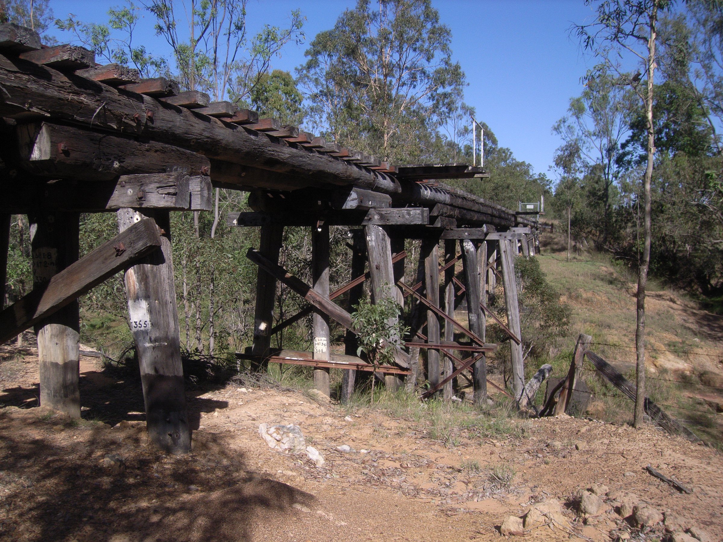
The Brisbane Valley Rail Trail is Australia’s longest rail trail: 161 km of gravel on the old Brisbane Valley railway line, running from Wulkuraka at Ipswich to Yarraman. It is off-road and traffic-free, and it passes through Fernvale, Lowood, Coominya, Esk, Toogoolawah, Moore, Linville, Blackbutt and Yarraman, so you can ride or walk any stretch you like and finish with a pie, a pub meal or a bed.
Most people do a day trip from one town, or a multi-day ride with a shuttle back to the car. This guide covers the sections, what the surface is like, where to hire a bike, where to camp and how to get to the start.
Brisbane Valley Rail Trail sections and distances
Experience Somerset splits the trail into 11 sections. Distances run from south to north, and the running total from Wulkuraka is worked out from them:
- Wulkuraka to Fernvale: 23 km (23 km in). Moderate grade; the surface can be rough.
- Fernvale to Lowood: 8 km (31 km in). Low to moderate grade and an easy surface, the easiest section.
- Lowood to Coominya: 12 km (43 km in). Moderate grade; the surface can be rough.
- Coominya to Esk: 24 km (67 km in). Moderate to high fitness needed.
- Esk to Toogoolawah: 19 km (86 km in). Moderate to high fitness needed.
- Toogoolawah to Harlin: 14 km (100 km in). Easy grade and surface.
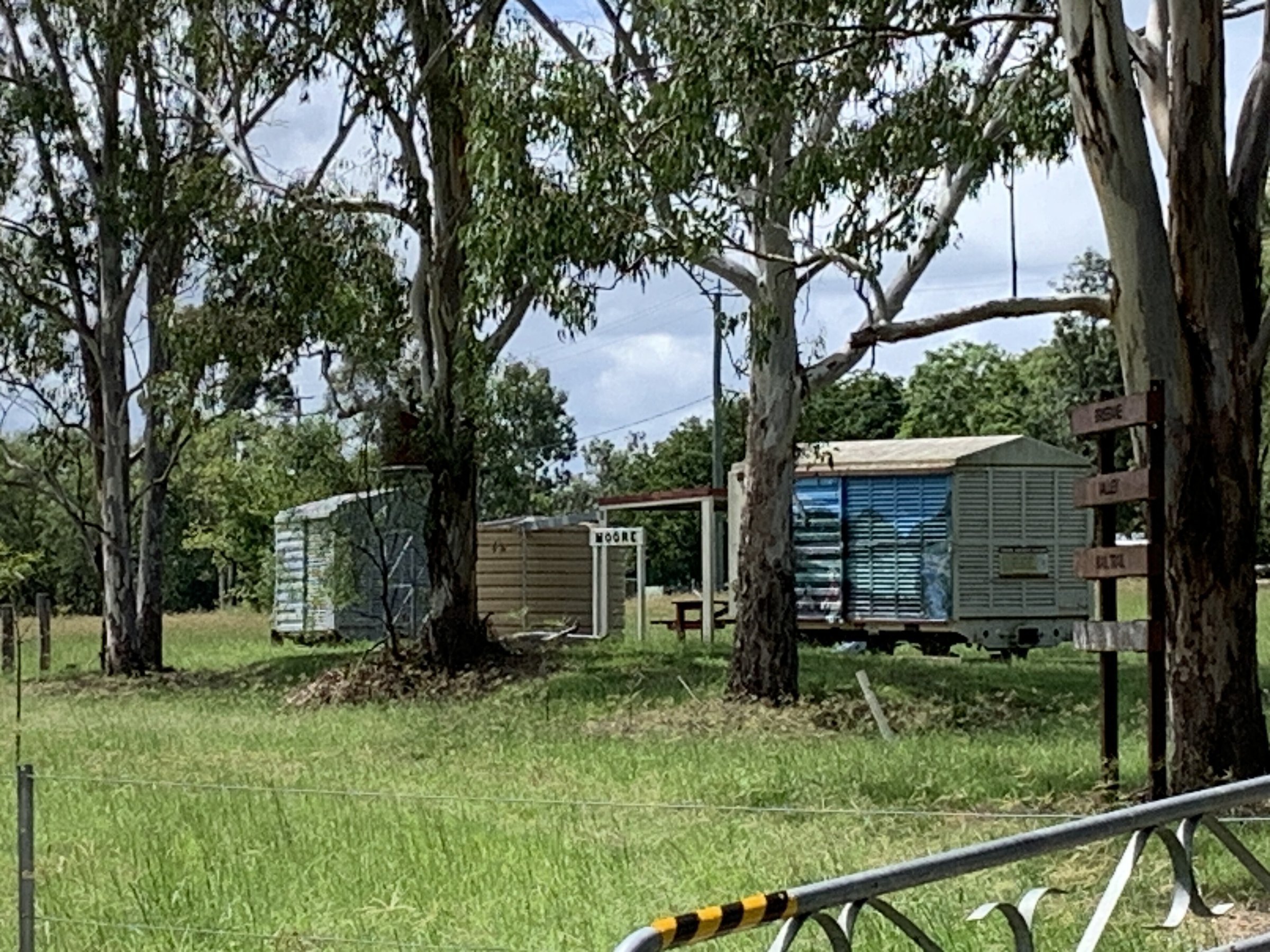
- Harlin to Moore: 13 km (113 km in). Easy grade and surface.
- Moore to Linville: 7 km (120 km in). Moderate grade; the surface can be rough.
- Linville to Benarkin: 17 km (137 km in). Advanced grade, rough surface, uphill when heading north.
- Benarkin to Blackbutt: 5 km (142 km in). Moderate grade, rough surface.
- Blackbutt to Yarraman: 19 km (161 km in). Moderate grade; the surface can be rough.
The trail reached its full 161 km in 2018, when the missing link between Toogoolawah and Moore opened.
What the trail is like
The trail follows a disused railway corridor and is mostly compacted gravel, with rockier, rougher stretches through the Blackbutt Range and between Yarraman and Nukku. Gravel bikes and mountain bikes are the right choice. Road bikes are not suitable.
Gradients are gentle for a hill region, but riding north to south is easier because there is more downhill. Most towns have water, and many cafes and pubs will let you charge an e-bike if you buy a meal. Between towns you need to carry your own drinking water.
Mobile coverage is generally good with some black spots, and Telstra is the most reliable. Carry a first aid kit with a snake bite bandage, basic bike tools and puncture repair gear.
Highlights along the trail
- Fernvale: a mural of 27 panels by local artist Susan McConnel, plus markets on Sundays. See Fernvale.
- Clarendon: the heritage-listed Lockyer Creek railway bridge.
- Cooragook: the Logan Creek bridge, at the first gully north of Coominya.
- Harlin: the heritage-listed Yimbun railway tunnel at Sinnamons Lane and the Harlin rail bridge.
- Toogoolawah: The Condensery, which houses the Somerset Regional Art Gallery and a visitor information centre at 29 Factory Road.
- Linville to Blackbutt: the uphill, rough climb through the Blackbutt Range, with old station yards at Linville and Benarkin used for camping.
- Blackbutt: the Roy Emerson Museum, 19 km before the northern end.
Where to start: trailheads and towns
The southern trailhead is at Grace Street, Wulkuraka, and the northern end is Yarraman Station Park. In between, most people start from a town with parking and food.
Fernvale is the easiest start: the car park at the visitor centre (1483 Brisbane Valley Highway) sits on the old station site, and the 8 km run to Lowood is the easiest section. Esk is the middle of the trail, with a visitor information centre at 82 Ipswich Street, a caravan park, a pub and cafes. Toogoolawah suits a ride along the easy stretch to Harlin and Moore.
Kilcoy is not on the trail, but the trail site lists it as the gateway to Somerset. See Kilcoy for the town, Yowie Park and the lake country.
Brisbane Valley Rail Trail bike hire and shuttles
- Brisbane Valley Rail Trail Cycles (Esk): hardtail and electric mountain bikes.
- Out There Cycling (Wulkuraka): scheduled shuttle transfers from Wulkuraka to Yarraman, so you can ride one way. It also runs self-guided tours.
- The Bike Hire Company, Bikeline Ipswich and Forbes MTB: bike hire and shuttles, listed on the trail’s bike hire page.
Prices are on each operator’s own page. Book ahead for a one-way ride.
Camping and accommodation on the Brisbane Valley Rail Trail
The trail’s camping guide warns that wild camping is prohibited because of bushfire risk, and open fires are not allowed. Camping is not permitted in Fernvale town, and Lowood showgrounds, 7 km away, is the better option.
- Lowood: Lowood Showgrounds caravan park, 7 km from Fernvale.
- Coominya: Coominya Camping and Caravan Park, about 3 km from town but close to the trail.
- Esk: Esk Caravan Park. There is no free camping in Esk.
- Toogoolawah: Toogoolawah Showgrounds (except during events) and rest areas opposite the old station and in Polly Crandell Park.
- Moore and Harlin: designated roadside rest areas, with an amenities block with showers at Moore. Tents are technically not permitted in roadside rest areas.
- Linville and Benarkin: free overnight camping in the old station yards, with shower blocks.
- Blackbutt: Blackbutt Show Grounds, powered and unpowered sites with toilets and hot showers.
- Yarraman: Yarraman Caravan Park, and free camping at the old Yarraman weir with a toilet.
If you would rather sleep in a bed, there is a trail accommodation guide with listings in Blackbutt, Coominya, Esk, Linville, Lowood, Moore, Toogoolawah and Yarraman. Rural kitchens often close early, so check ahead. For general camping tips see Cheap Camping Near Brisbane, and browse camping.
Is the Brisbane Valley Rail Trail dog friendly?
Yes, dogs are welcome on a leash. Keep in mind that dogs are not allowed at Lake Wivenhoe, which is upstream of Fernvale.
Planning your visit
- How long: as long as you like. Fernvale to Lowood is 8 km one way, and the whole trail is 161 km, so most people split it into several days with a shuttle.
- Best time: the trail is open year-round. Check for closures after severe storms and avoid magpie season on long rides if swooping bothers you.
- Cost: no trail ticket or pass is listed. You pay for bike hire, shuttles, food and where you sleep.
- What to bring: a gravel or mountain bike, plenty of drinking water, a helmet, sunscreen, a first aid kit and puncture repair gear.
- Toilets: in the towns, with amenities blocks at Moore and Linville (coin-operated hot showers) and toilets at Wulkuraka trailhead and Fernvale.
- Accessibility: no access details are published for the trail as a whole. The Fernvale to Lowood stretch has an easy surface and a low to moderate grade.
Hiking the whole trail or a stretch of it? See Hiking in South East Queensland for what to bring.
Getting there and parking
By car from the Brisbane CBD, Wulkuraka is about 47 km, about 50 minutes. Fernvale is about 61 km, about 1 hour. Esk is about 100 km, about 90 minutes. Toogoolawah is about 120 km, about 1 hour 50 minutes. Yarraman is about 167 km, about 2.5 hours. These are without traffic.
Parking: the Wulkuraka trailhead on Grace Street has parking with CCTV and toilets. Borallon Station Road has a parking area with security cameras that is suggested for multi-day trips. The Fernvale visitor centre car park is in front of the centre. There is pay parking near Ipswich Station in Brisbane Street. The trail’s parking guide lists no fees for the first three.
By train, Wulkuraka station is on the Ipswich/Rosewood line. Wulkuraka trains run less often than Ipswich trains and sometimes do not run during track works, so check Translink or call 13 12 30 before you go. The station itself has no cafes, toilets or drinking fountain. To get from Ipswich station to Wulkuraka by bike, cross the pedestrian walkway on the southern side of the Bremer River rail bridge and carry your bike up the stairs.
By bus, Translink route 529 runs between Ipswich and Toogoolawah, Monday to Saturday, and stops at Fernvale. Ask Translink whether bikes are allowed on board.
The official site is brisbanevalleyrailtrail.com.au, and Experience Somerset has maps and the section guide. Details can change, so check before you go.
Nearby
- Fernvale – Sunday markets, bakeries and the easiest rail trail start.
- Lake Wivenhoe – swimming, boating and trails upstream of Fernvale.
- Kilcoy – Yowie Park and a base for Lake Somerset.
- Somerset Dam – swimming, picnics and boating at Lake Somerset.
Browse more bike trails and the Somerset Region.
Quick answers
How long is the Brisbane Valley Rail Trail?
161 km, from Wulkuraka at Ipswich to Yarraman, in 11 sections of 5 to 24 km.
Where does the Brisbane Valley Rail Trail start?
The southern end is at Wulkuraka, Ipswich, and the northern end is Yarraman Station Park. Fernvale is a popular place to start.
Can you ride the Brisbane Valley Rail Trail on a road bike?
No. The surface is mostly compacted gravel and rough in places, so use a gravel bike or mountain bike. Electric mountain bikes can be hired at Esk.
Can you walk the Brisbane Valley Rail Trail?
Yes. It is open to walkers, cyclists and horse riders.
Are dogs allowed on the Brisbane Valley Rail Trail?
Yes, on a leash.
Can you camp on the Brisbane Valley Rail Trail?
Yes, at showgrounds, caravan parks and rest areas along the route, including free overnight camping in the old station yards at Linville and Benarkin. Wild camping and open fires are prohibited.
Is it easier to ride north or south?
North to south is easier because there is more downhill.
0 Comments