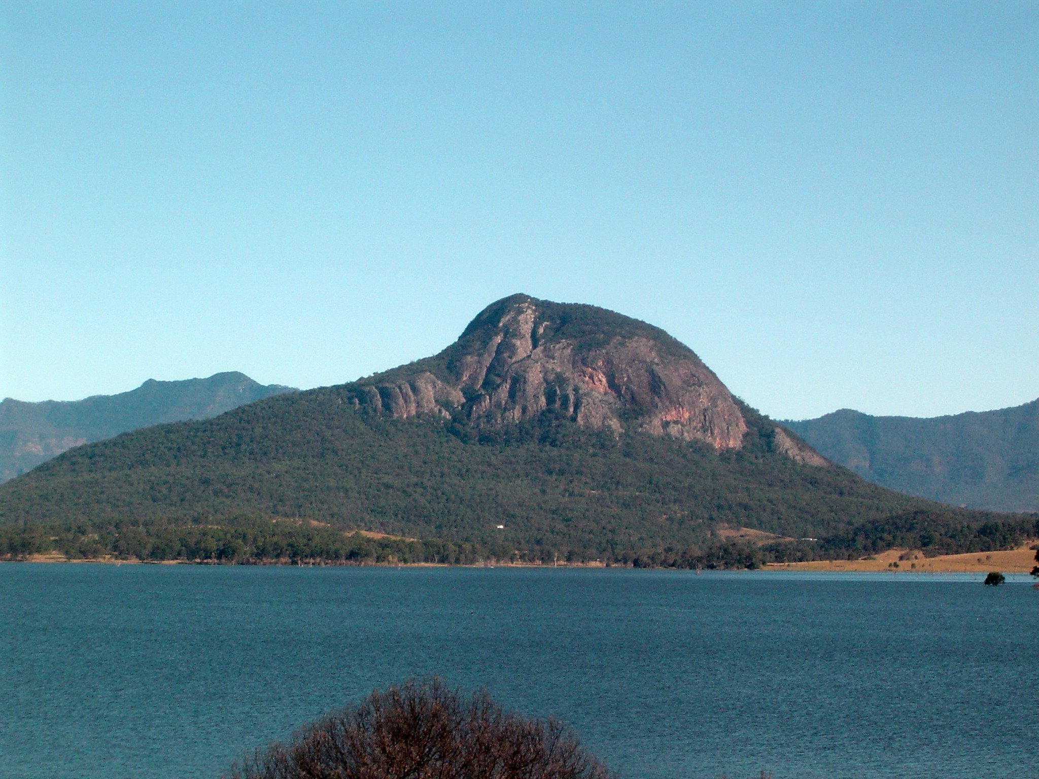
Mount Greville is a steep volcanic peak in Moogerah Peaks National Park, about 100 km south-west of Brisbane, and the Mount Greville hike is one of the Scenic Rim’s tougher summit climbs. It rises above Lake Moogerah and the Fassifern Valley, just outside Boonah.
This is a climb for experienced, self-reliant walkers. The summit routes are not formed walking tracks, they are not marked, and there are no facilities on the mountain.
About the mountain
Mount Greville is a cone-shaped, deeply fissured volcanic plug about 23 million years old. The Uragapul people know it as Meebatboogan, which means place where the eagles rest. Explorer Allan Cunningham named it in 1828 after the Scottish botanist Robert Kaye Greville.
It is one of the Scenic Rim peaks, alongside Mount Edwards, Mount Moon and Mount French in the same national park. The easiest way to see the whole mountain is from the picnic area at Lake Moogerah.
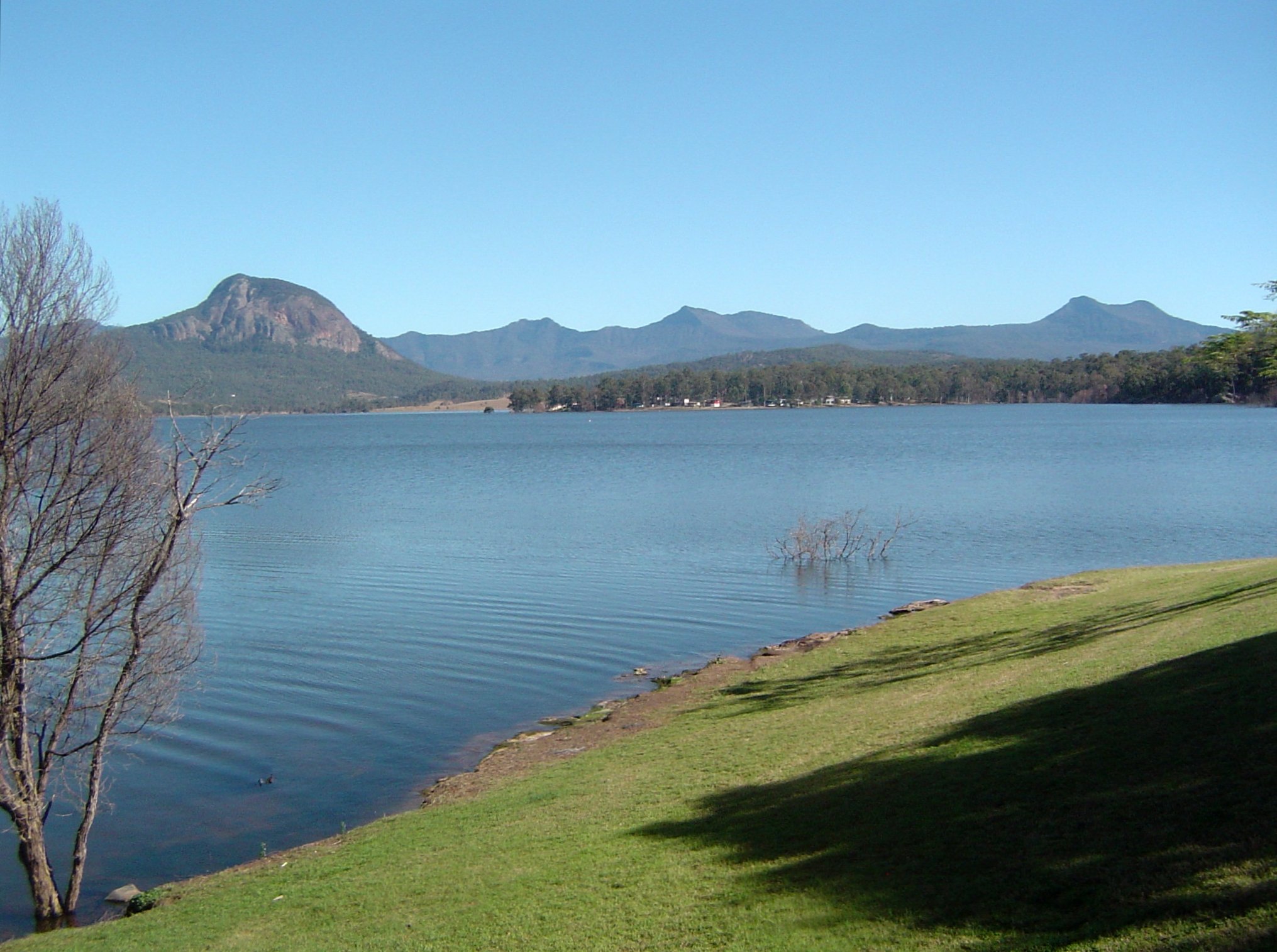
Seeing Mount Greville without climbing it
If the summit routes are more than you want, you can still get a good look at the mountain from the picnic area at Lake Moogerah. From the lake shore Mount Greville sits above the water, with Mount Mitchell and Spicers Peak in the background on a clear day.
That makes it an easy add-on to a lake day, and a good way to scout the mountain before you decide whether to climb it. The Lake Moogerah guide has the lake side of the trip.
Mount Greville summit routes
There are three ways to the top: Waterfall Gorge, Palm Gully and the Southeast route. Two gorges cut into the south-eastern side of the mountain. Queensland Parks lists all three as summit routes, not walking tracks, and says you must be self-reliant because there are no facilities or formed routes.
Southeast route
The south-eastern route is generally described as the easiest way to the summit. Higher up it passes stands of Eucalyptus dura. The walking site TrailHiking lists it at about 5 km and about 3 hours for the hike, describes it as a rough bush trail through an undeveloped section of the park, and says the tracks are not marked but are quite easy to follow. Queensland Parks estimates about 5 to 6 hours return and advises planning to be back before dark, so allow the longer time.
Waterfall Gorge and Palm Gully
Palm Gorge holds a nearly pure stand of piccabeen palms. TrailHiking rates its gorge circuit as grade 4 (hard), about 5 km and 2.5 hours, and says that grade suits experienced bushwalkers who can manage their own navigation, weather and emergencies.
Is Mount Greville right for you?
TrailHiking grades the Southeast route 5 on a five-grade scale and describes it as for very experienced bushwalkers. Queensland Parks says the routes suit only experienced people and are unsuitable for young children and inexperienced walkers.
If you are newer to bushwalking, start with a shorter summit such as Mount Ngungun and build up to this one. Going with a friend or a bushwalking club is safer than going alone.
Safety on Mount Greville
- You must be self-sufficient. The routes are not marked and there are no facilities.
- Climbing can be dangerous after rain because the rocks are slippery and the route runs close to sheer cliffs.
- Take plenty of water, sun protection and a map or navigation app that works offline.
- Start early and plan to be back before dark.
Planning your visit
- Who it suits: experienced bushwalkers who are comfortable with steep, rocky, unmarked ground.
- How long: Queensland Parks suggests about 5 to 6 hours return for the summit; walking sites list shorter times, so plan for the longer one.
- Best time: dry days. Avoid it after rain.
- What to bring: water, food, a hat, sturdy boots, a charged phone and an offline map.
Getting there and parking
Mount Greville is about 100 km south-west of the Brisbane CBD, about 1 hour 30 minutes by car, via Boonah and Lake Moogerah. Check current access details and closures on the Queensland Parks page for Moogerah Peaks National Park before you go.
Boonah is the nearest town for supplies, and the Boonah guide covers what is there.
Nearby
- Lake Moogerah – the lake and picnic area with the classic view of the mountain.
- Boonah – the closest town in the Fassifern Valley.
- Spicers Gap Road – a scenic drive with the same Scenic Rim peaks in view.
Browse more hiking trails and the Scenic Rim.
You might also like
- Mount Barney – another big Scenic Rim peak, for experienced walkers.
- Mount Ngungun – a much shorter summit walk with wide views.
- Scenic Rim Trail (Clumber)
Quick answers
Is there a marked track up Mount Greville?
No. The summit routes are not formed walking tracks and are not marked, so you need to be self-reliant.
How many routes are there to the top?
Three: Waterfall Gorge, Palm Gully and the Southeast route.
How long does the Mount Greville hike take?
Queensland Parks suggests about 5 to 6 hours return. TrailHiking lists the Southeast route at about 5 km and about 3 hours, so plan for the longer time.
Is Mount Greville safe after rain?
No. The rocks get slippery and the route is close to sheer cliffs, so wait for dry weather.



0 Comments