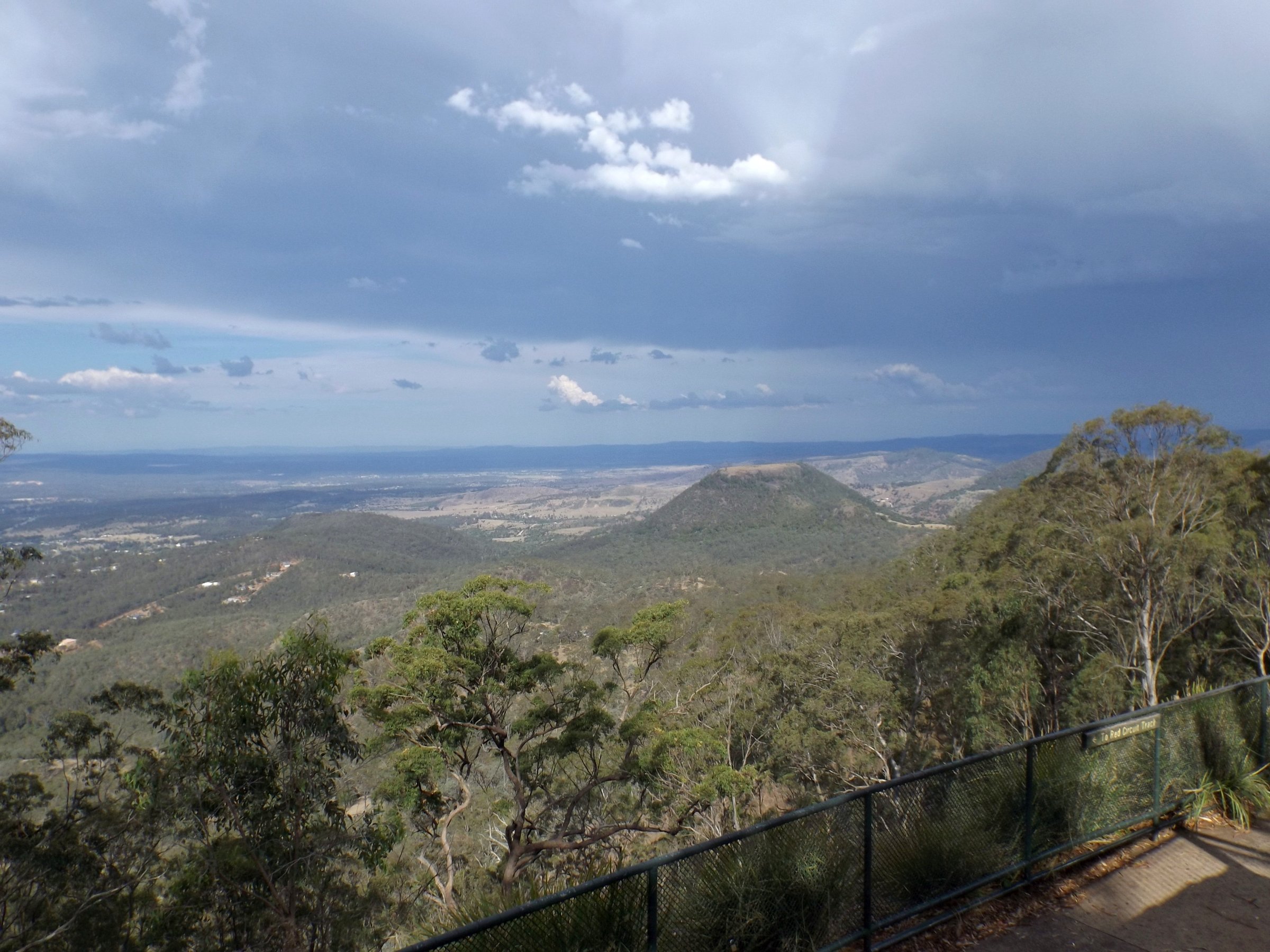
The Toowoomba Range is the steep eastern edge of the Great Dividing Range, where the road from Brisbane climbs up to Toowoomba. Most people meet it as a drive, and the best reason to stop is the lookouts at the top, which look east over the Lockyer Valley.
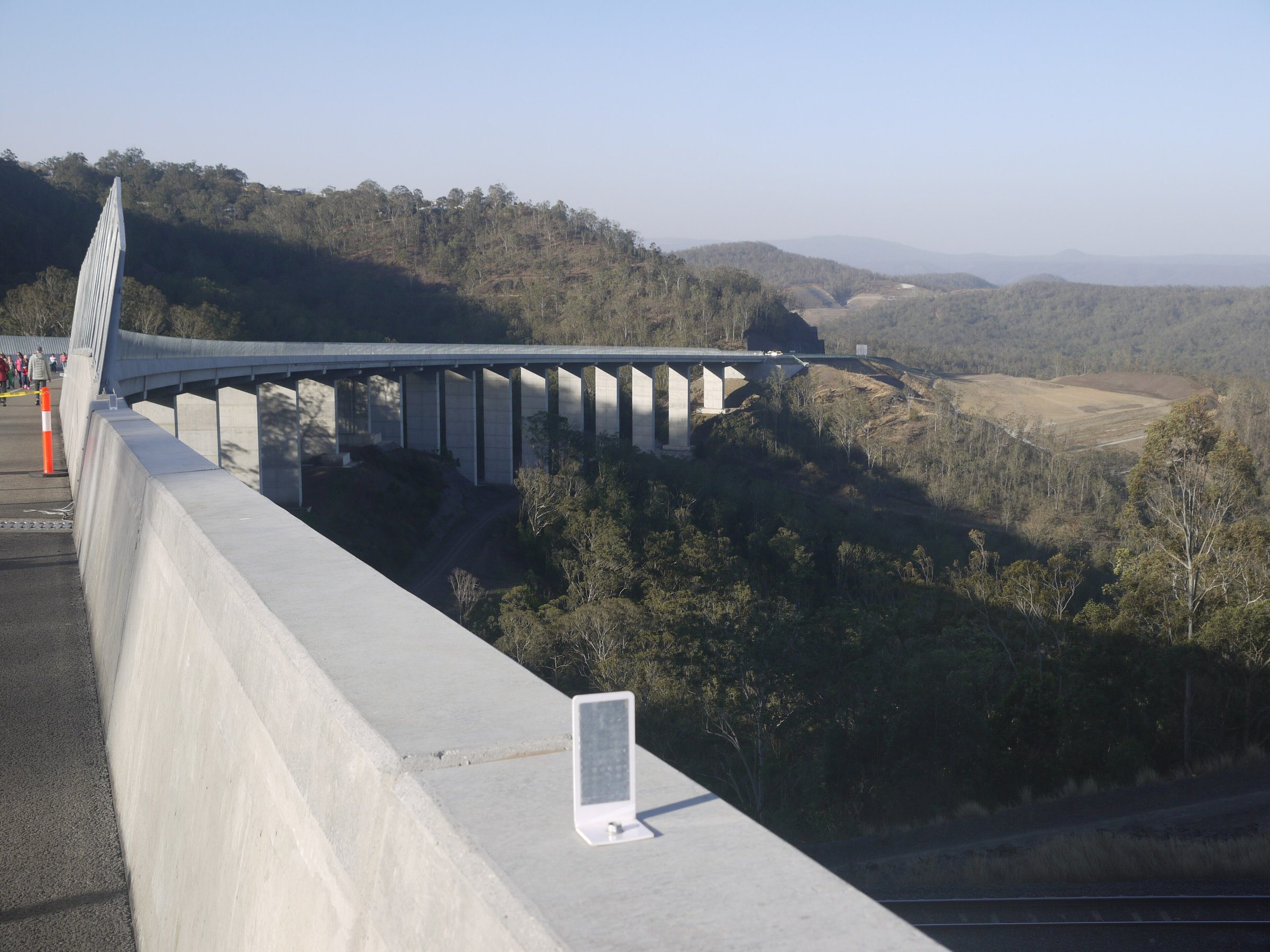
There are two ways up. The old range road, now called the Toowoomba Connection Road, is the winding climb into the city. The Toowoomba Bypass is the modern toll road that skirts the city to the north.
The Toowoomba Range road
The Toowoomba Connection Road (route A21) is the former Warrego Highway through Toowoomba. It leaves the Warrego Highway at Helidon Spa, runs through Postmans Ridge and Withcott, then climbs the range into the city. The climb has tight corners and grades of up to about 10 per cent.
The current alignment of the range road dates from 1939. It replaced the original Toll Bar Road, opened in 1855, and a piece of that old route survives as Old Toll Bar Road. When the bypass opened the Connection Road kept carrying local and visitor traffic, and the government says it has no plans to toll it.
Take it slowly. Heavy vehicles over 4.5 tonnes (not counting motorhomes and buses) must use the bypass unless they are going into Toowoomba or travelling on the New England Highway, so the range road is mostly cars and local trucks.
The Toowoomba Bypass
The Toowoomba Bypass (the Toowoomba Second Range Crossing) opened on 8 September 2019. It is 41.3 km long, runs from Helidon Spa to Athol, and crosses the range on the 800 m Multuggerah Viaduct.
It is a toll road, and all vehicles that use it must pay. The toll point is at Cranley, just east of the Mort Street interchange, and tolling is free-flow, so you do not stop. A car pays $3.00 from 1 July 2026, and tolls rise each 1 July in line with the Brisbane Consumer Price Index. Linkt collects the tolls for the Queensland Government. If you have no tag you have up to three days to arrange payment, and the details are on the Queensland Government bypass tolling page.
Lookouts on the Toowoomba Range
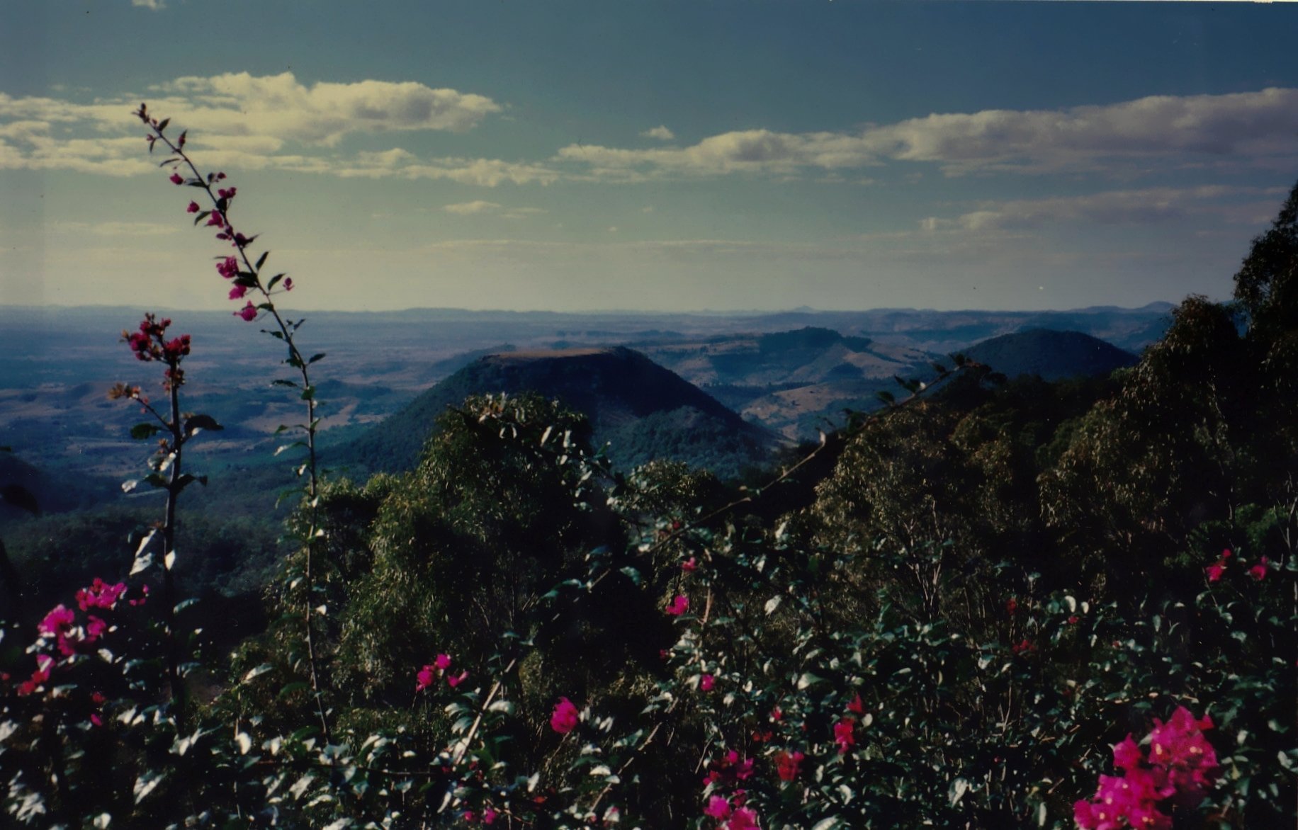
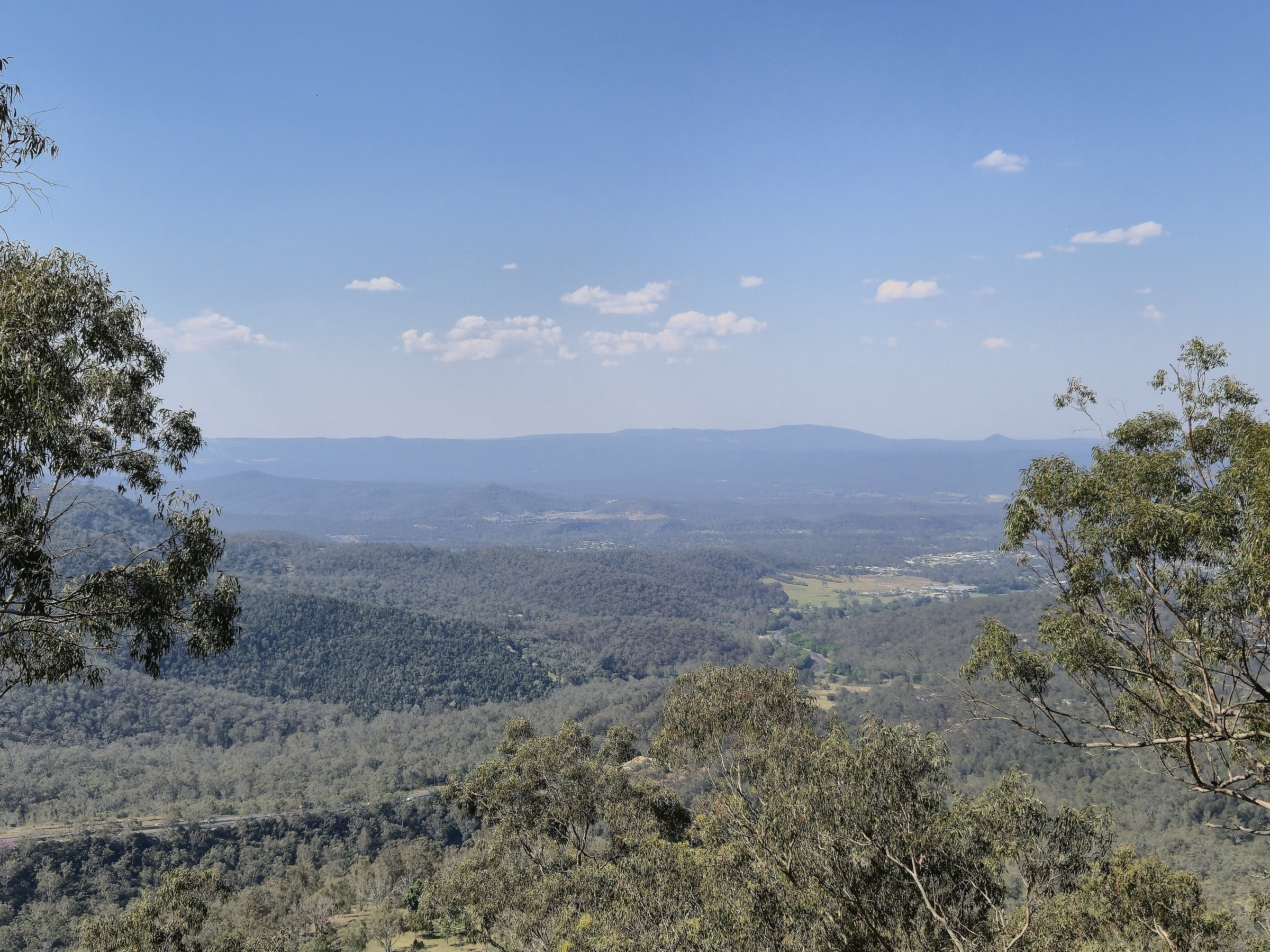
The lookouts are in the Picnic Point parklands, on the range edge on the eastern side of the city. The main Picnic Point lookout looks east over the Lockyer Valley, and on a clear day Table Top Mountain stands out in the distance.
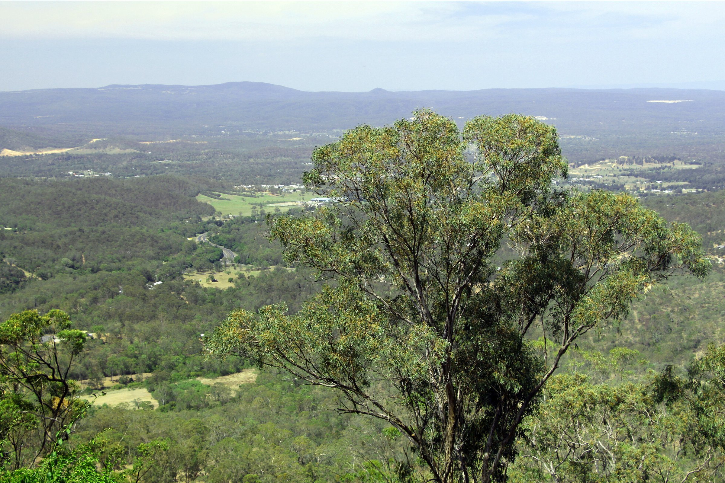
The Tobruk Memorial Drive Lookout is a short way along the same escarpment. It opened in December 2020 with a viewing platform, a walkway and connecting paths, and it is known for its view of Table Top Mountain and the Lockyer Valley. There is parking along Tobruk Memorial Drive, including disability spaces and some 10-minute spaces next to the lookout.
Both are free. Picnic Point also has playgrounds, BBQs, toilets and bush walks, so you can turn a quick view into a longer stop. Our Picnic Point guide covers those, and the lookouts are listed with other lookouts around the region.
Spring flowers and the railway on the range
The range is also where the railway climbs to Toowoomba. North of the city, Spring Bluff has free station gardens that are known for spring flowers, and the Spring Bluff Railway Station sits on the railway line up the range. In September the gardens are part of the Toowoomba Carnival of Flowers.
For rainforest walks on the same range, head north-east to Ravensbourne and Ravensbourne National Park.
Planning your visit
- How long: 30 minutes for the lookouts, an hour or two with Picnic Point’s walks and playgrounds.
- Best time: A clear day, for the long views over the valley.
- Cost: The lookouts are free. The bypass has a toll; the range road has none.
- Dogs: Dogs must be on a leash at Picnic Point.
- What to bring: Water and a hat. Allow time on the range road, which is steep and winding.
Getting to the Toowoomba Range and parking
Toowoomba is about 125 km from the Brisbane CBD, around 110 minutes by car without traffic. From the city centre (Queens Park) the Picnic Point lookouts are about 5 km and 10 minutes by car. Use the Toowoomba Regional Council Picnic Point page for the car parks. There are several, including at Lions Park and Heller Street.
For the rest of the day in town, add Queens Park, Toowoomba Botanic Gardens or Toowoomba City Hall, or browse everything in Toowoomba and more scenic drives.
Nearby
- Picnic Point, Toowoomba – the main lookout, waterfall and playgrounds on the range edge.
- Queens Park – the city’s gardens and playgrounds, 10 minutes away.
- Spring Bluff – heritage station gardens north of the city.
- Ravensbourne National Park – rainforest walks on the range.
You might also like
- Beerwah (Glass House Mountains)
- Flaxton (Sunshine Coast Hinterland)
- Imbil (Sunshine Coast Hinterland)
Quick answers
What is the Toowoomba Range?
It is the eastern edge of the Great Dividing Range at Toowoomba, where the road from the Lockyer Valley climbs up to the city. People also mean the road itself, now the Toowoomba Connection Road.
Is the Toowoomba Range road a toll road?
No. The Toowoomba Connection Road over the range is free. The Toowoomba Bypass is the toll road, and every vehicle pays.
How much is the Toowoomba Bypass toll for a car?
A car pays $3.00 from 1 July 2026. Tolls rise each 1 July, so check the Queensland Government page before you go.
Where are the best lookouts on the Toowoomba Range?
Picnic Point and the Tobruk Memorial Drive Lookout, both free, look east over the Lockyer Valley towards Table Top Mountain.
How long does it take to drive up the Toowoomba Range from Brisbane?
Toowoomba is about 110 minutes by car from the Brisbane CBD without traffic.


0 Comments