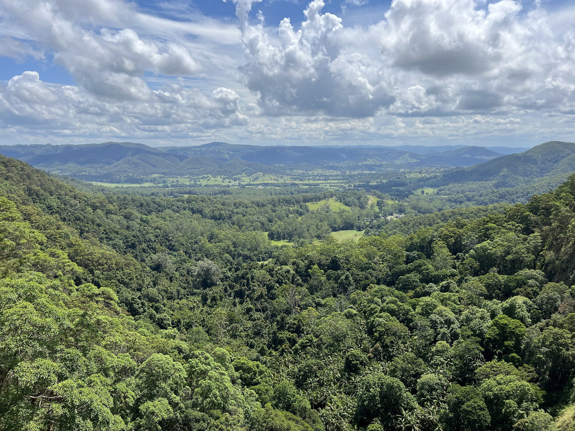
Mapleton Falls National Park is a small rainforest and eucalypt reserve on the Blackall Range, with a lookout over the Obi Obi Valley and the top of a 120 m waterfall. It is one of the easiest stops in the Sunshine Coast Hinterland: the lookout is a 50 m walk from the car park, and there is a picnic lawn right beside it.
If you are planning a visit to Mapleton Falls with kids or grandparents in mind, this is the one to pick for views without a hard walk. Add the Wompoo Circuit if you want a bit of rainforest as well.
Mapleton Falls lookout
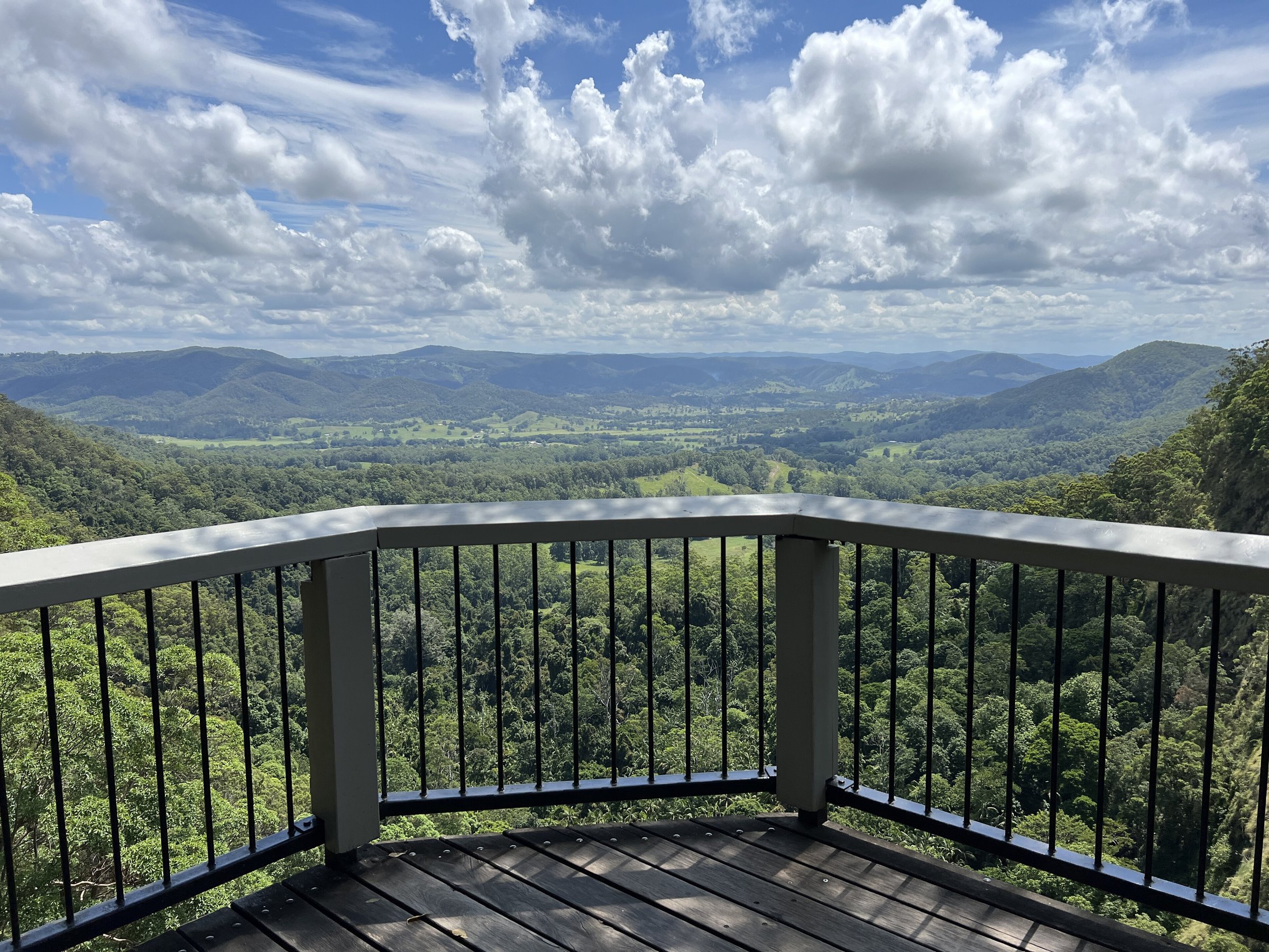
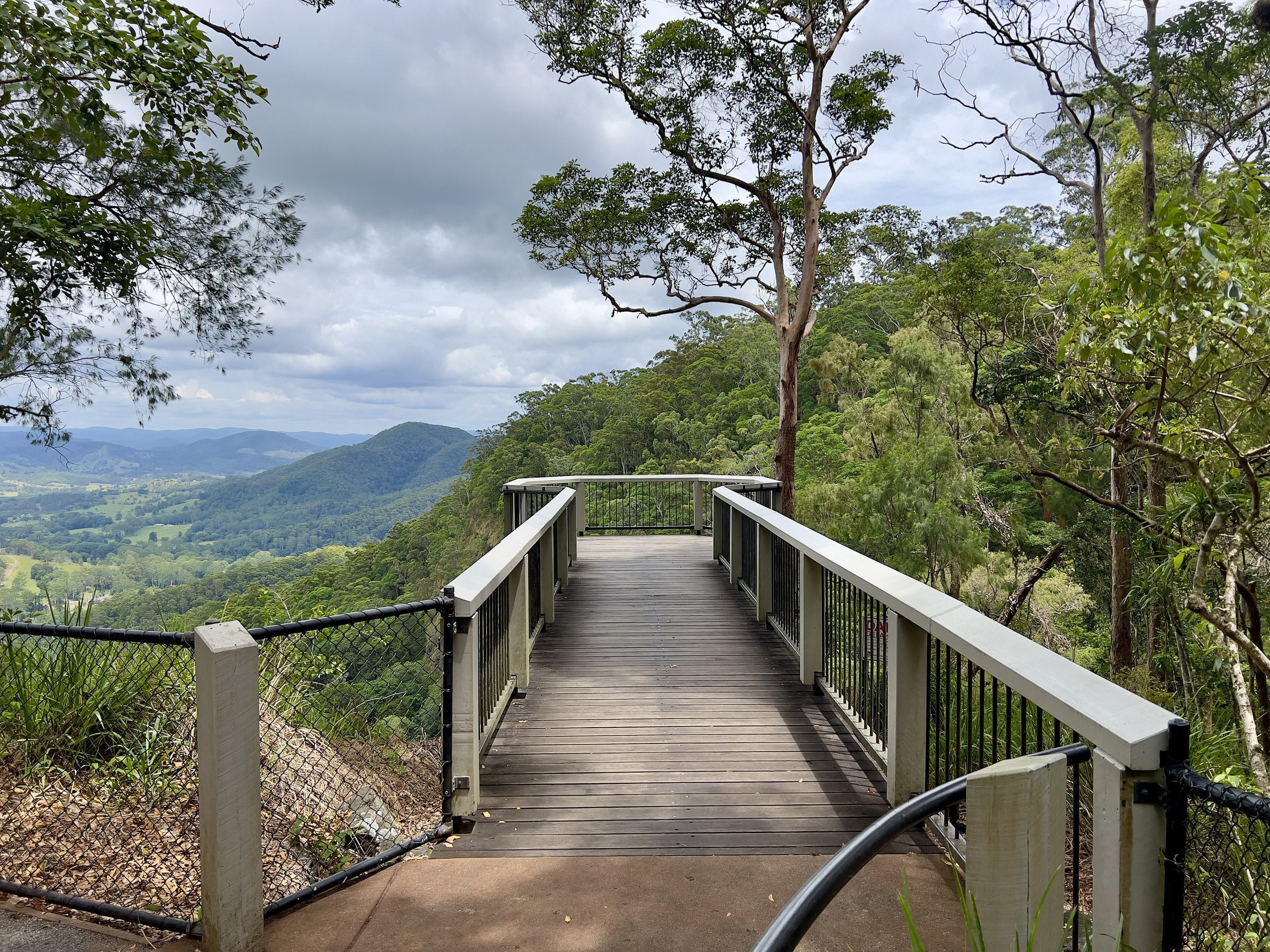
The Mapleton Falls lookout is a viewing platform about 50 m return from the car park, roughly a five-minute stroll. It looks out over the Obi Obi Valley and the top of Mapleton Falls, where the water drops 120 m.
The lookout is next to the car park, and Queensland Parks describes it as wheelchair accessible. Toilets, including an accessible one, are beside the car park.
From August to September, Australian peregrine falcons can be seen near the cliffs. Bring binoculars if you have them.
Wompoo Circuit walk
The Wompoo Circuit is a 1.3 km return walk, allow about 45 minutes. It winds through rainforest and eucalypt forest. It has steep steps and inclines, so it is not suitable for wheelchairs or prams.
The circuit is named for the wompoo fruit-dove, a large, colourful pigeon that you can often hear calling in the rainforest.
Picnic area and facilities
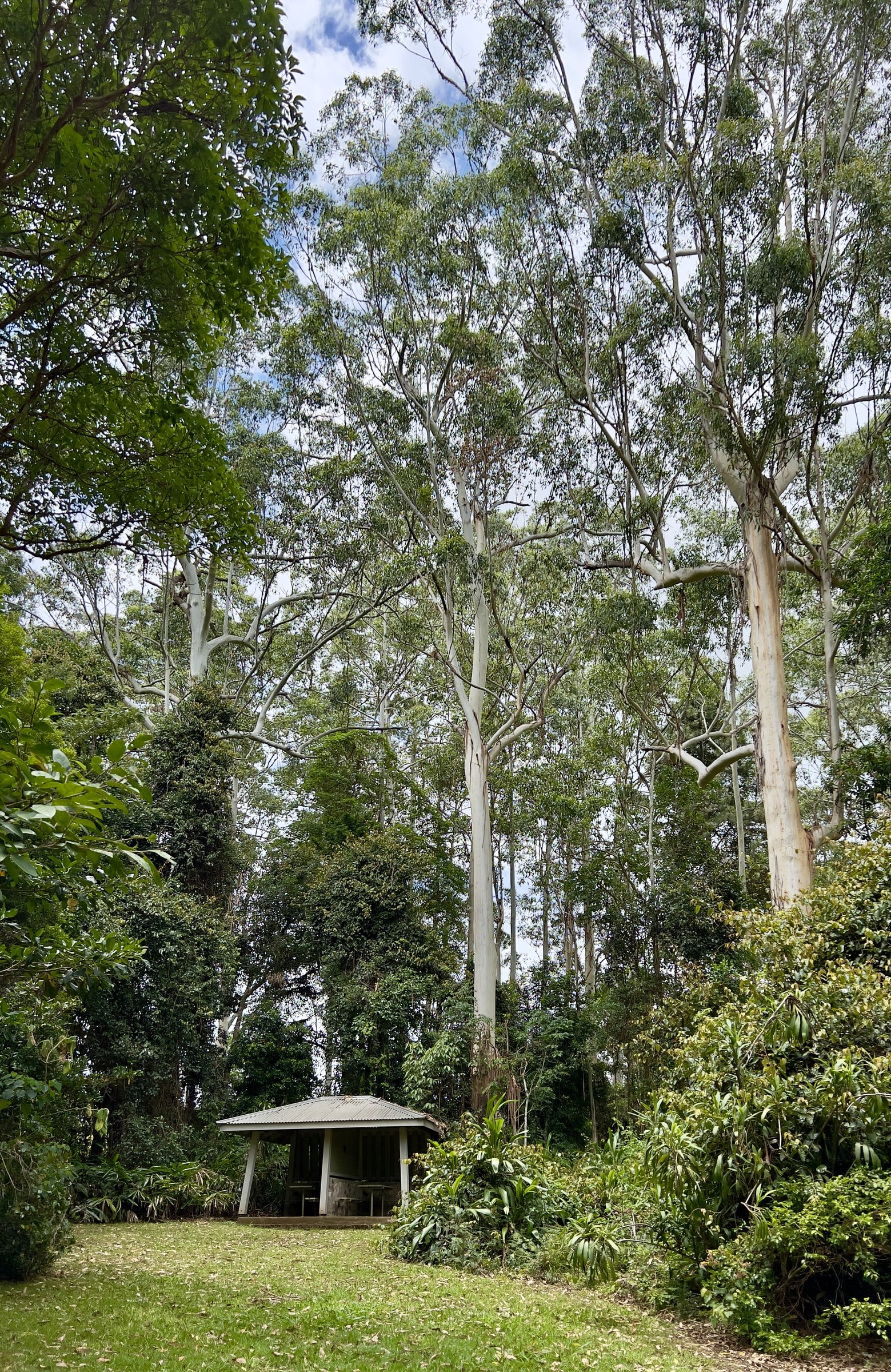
The picnic area has tables and an open grassy area for rugs, next to the lookout. Toilets are beside the car park.
Plan this as a viewpoint and picnic stop. The park’s listed activities are the lookout, the Wompoo Circuit and picnicking, and none of them involves reaching the water below the falls.
About Mapleton Falls National Park
The park is small, about 26 hectares, and sits just outside the town of Mapleton. The waterfall is on Pencil Creek and drops about 120 m. The area was set aside as a forest reserve in 1938 and became a national park in 1973.
The Sunshine Coast Hinterland Great Walk, a long-distance walking track, also passes through the park. It is a much bigger commitment than the lookout, so it suits experienced walkers who have planned ahead.
Because the park is so compact, it pairs easily with a drive along the Blackall Range. A stop here, a wander through Mapleton and a visit to nearby Kondalilla Falls or Montville fills a day without much driving.
Is Mapleton Falls dog friendly?
No. Queensland Parks does not permit domestic animals, including pets, in national parks, apart from certified assistance animals. Leave dogs at home.
Planning your visit
- How long: About 15 minutes for the lookout alone, or about an hour with the Wompoo Circuit and a picnic.
- Best time: A clear day for the valley view. August and September for peregrine falcons.
- What to bring: Water, a hat, a picnic rug and binoculars. Closed shoes for the circuit.
- Accessibility: The lookout is wheelchair and pram accessible. The Wompoo Circuit has steep steps and inclines. Check the Queensland Parks page for current alerts and closures.
Getting to Mapleton Falls and parking
Mapleton Falls National Park is about 118 km from the Brisbane CBD, around 1 hour 45 minutes by car without traffic. Drive north on the Bruce Highway to Nambour, about 105 km, then west to Mapleton, about 11 km. In Mapleton turn onto Obi Obi Road, then onto Mapleton Falls Road, which ends at the park’s car park. The lookout and toilets are next to the car park.
From Montville it is about 16 km, around 25 minutes by car.
By public transport, take a train to Nambour, then Translink bus 890 towards Mapleton. It runs Monday to Friday only. Translink lists its stops in Mapleton town, not at the park, so a car is the practical way to reach the lookout. Check the route 890 timetable or call 13 12 30.
Nearby
- Kondalilla Falls – another Blackall Range waterfall, with a rainforest walk down to the falls.
- Montville – village with shops and cafes along the main street.
- Maleny – the hinterland town for markets and farm produce.
- Mary Cairncross Scenic Reserve – rainforest reserve near Maleny.
- Baroon Pocket Dam – the dam in the Obi Obi catchment.
- More waterfalls: Waterfalls. More from the region: Sunshine Coast Hinterland.
Quick answers
How long does it take to see Mapleton Falls?
The lookout is 50 m return, about 5 minutes. Allow about 45 minutes more for the 1.3 km Wompoo Circuit.
Can you swim at Mapleton Falls?
This is a lookout stop. The park’s listed activities are the lookout, the Wompoo Circuit and picnicking, and none of them reaches the water below the falls.
Are dogs allowed at Mapleton Falls National Park?
No. Domestic animals are not permitted in the park.
Is Mapleton Falls wheelchair and pram accessible?
The lookout is, and it is next to the car park. The 1.3 km Wompoo Circuit is not, because of steep steps and inclines.
How far is Mapleton Falls from Brisbane?
About 118 km, around 1 hour 45 minutes by car without traffic, via the Bruce Highway and Nambour.
Is there public transport to Mapleton Falls?
Take the train to Nambour, then bus 890 to Mapleton town on weekdays. Translink does not list a stop at the park.
0 Comments