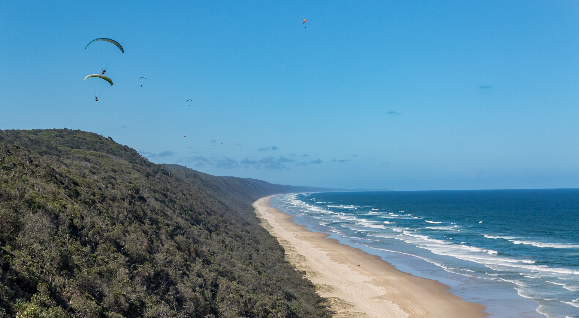
Teewah Beach is the long ocean beach on the Cooloola coast north of Noosa, known for its Coloured Sands cliffs, beach camping and the story of the Cherry Venture shipwreck. It is part of Great Sandy National Park and, for much of its length, a beach you drive on rather than walk to.
The beach stretches about 51 km from Double Island Point to the Noosa River, and much of it is a designated road, which makes it a 4WD route to Rainbow Beach and K’gari (Fraser Island).
You reach the southern end through Noosa North Shore, so a day here starts with the cable ferry from Tewantin and a plan around the tides.
Driving on Teewah Beach: the permit
Teewah Beach is in the Cooloola Recreation Area, and the Queensland Government says you must buy a permit before driving on the beaches at Cooloola. Camping and driving permits for Cooloola are booked through the Queensland National Parks website, and the ferry operator recommends booking at least six weeks ahead for popular spots, especially in school and public holidays.
Queensland Parks officers check that drivers have their permits. Read the Queensland Government vehicle permit page and buy before you leave home.
Tides, dunes and speed
Noosa Council’s advice is not to set off up the beach within two hours either side of high tide. The ferry operator tells drivers to travel through the Cooloola Recreation Area only at low tide. Where the two differ, go with the more cautious one and check tide times first.
The vegetated dunes are off limits to vehicles and fines apply. Obey the posted speed limits: police enforce them and target dangerous driving.
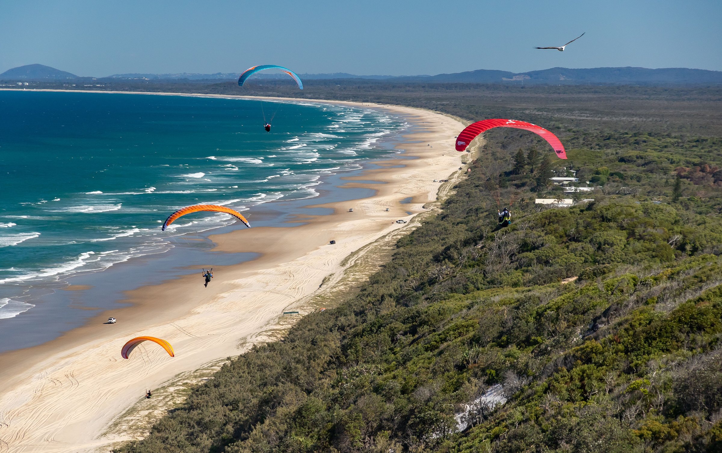
Teewah Coloured Sands
The Teewah Coloured Sands are sand cliffs along the beach, within Noosa North Shore. They rise up to about 200 metres, and their colours come from iron oxide and vegetable dyes. They are one of the main reasons people make the trip.
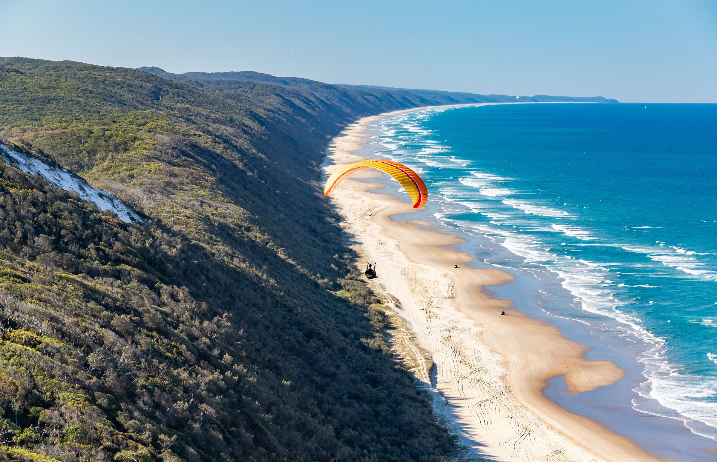
The Cherry Venture shipwreck
On 6 July 1973 the 1,600 tonne cargo ship Cherry Venture, sailing from Auckland to Brisbane, was caught in a storm and ran aground on Teewah Beach. Because it carried no cargo it sat high in the water, and high tides and swell pushed it far up the sand. The captain and all 24 crew survived, and nine major salvage attempts over the years failed.
Removal of the wreck began on 13 February 2007, after 34 years on the beach, because it was deteriorating and dangerous to visitors. The site was then buried for visitor safety, although later storms exposed the hull again, in 2013 and 2018, so parts of it can still turn up after big seas. The propeller was taken off in 1985 and is now a monument in the township of Rainbow Beach. This history comes from Noosa Council’s heritage records.
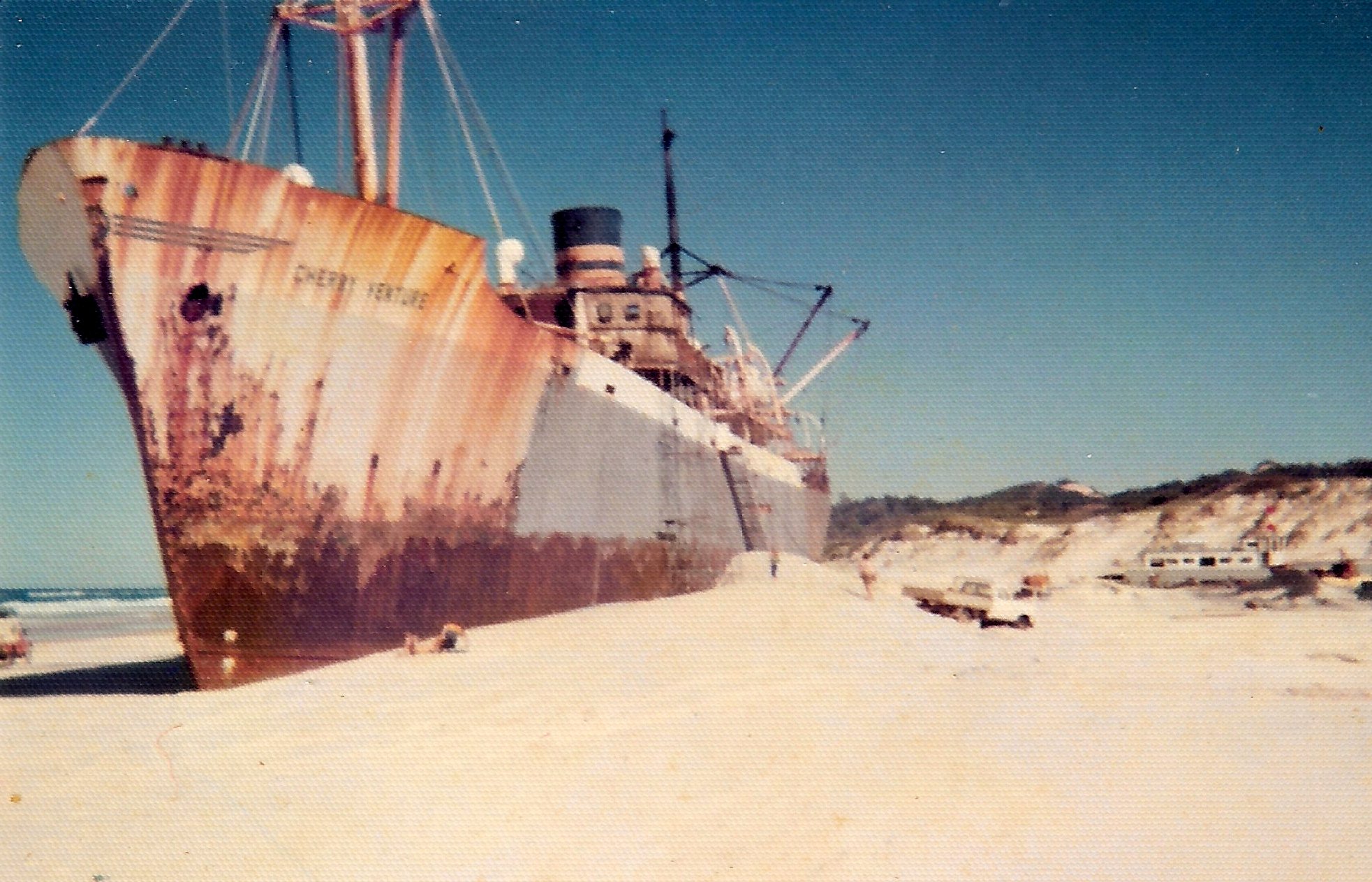
Camping at Teewah Beach
Beach camping is in the same recreation area, so you need both a vehicle access permit and a camping permit, paid for before you arrive. Capacity is limited, so book early for peak periods, and rangers may visit camps during the day to check permits. The ferry operator’s camping and permits page explains how to book through the Queensland National Parks booking service. For the ferry and campsite side of the story, see Noosa North Shore.
Planning your visit
- How long: a full day if you are driving the beach and allowing for the ferry and the tide.
- Best time: around low tide; check the tide times before you cross.
- Cost: a vehicle access permit and the ferry fare, plus a camping permit if you stay. Prices are on the official pages.
- What to bring: your permit, tide times, water, food and fuel. Take your rubbish with you.
- Toilets: bathrooms on Maximillion Road on the left of the ferry approach, and at the Parks and Forests office on Moorindil Street, about 200 m before the ferry approach. Neither has rubbish collection.
- Dump point: there is one on the wilderness track, roughly halfway between Third Cutting and First Cutting.
Getting there
The ferry leaves from the river end of Moorindil Street in Tewantin and lands at Maximillion Road on Noosa North Shore. Two cable ferries carry vehicles and foot passengers, departing about every 10 minutes every day of the year: Sunday to Thursday 5.30 am to 10.20 pm, Friday and Saturday 5.30 am to 12.20 am. See the council’s ferry page and our Noosa ferry guide for fares and stops.
The ferry is about 1 hour 55 minutes by car from the Brisbane CBD, about 137 km by road, before the beach driving. Heading south, drivers leave the beach at the Third Cutting and follow the wilderness track to the ferry. No public transport onto the beach is listed, so plan a trip to Tewantin with the Translink Journey Planner or call 13 12 30.
Nearby
- Noosa North Shore – the ferry, the camping and the road to the beach.
- Noosa Ferry – timetable and fares for the crossing.
- Noosa Main Beach – a beach you can reach without driving on sand.
- Noosa National Park – coastal walks on the Noosa Heads side.
- Noosa River – paddling and cruises on the river you cross to get here.
- Lake Cootharaba – another water day out in the Noosa area.
Browse more beaches, camping spots and Noosa places.
You might also like
- Pottsville (Gold Coast)
- Little Cove (Noosa Heads)
- Alexandria Bay (Noosa National Park)
Quick answers
Do you need a permit for Teewah Beach?
To drive on it, yes. The Queensland Government says you must buy a permit before driving on the beaches at Cooloola, which includes Teewah Beach.
Can you camp on Teewah Beach?
Yes, in the Cooloola Recreation Area, with both a vehicle access permit and a camping permit paid for before you arrive. Book early for busy periods.
What is the best tide for driving Teewah Beach?
Low tide. The ferry operator says to travel through Cooloola only at low tide, and Noosa Council says not to set off within two hours either side of high tide.
Can you still see the Cherry Venture shipwreck?
Not as a ship. Removal began in February 2007 and the site was buried, though storms have exposed parts of the hull since, in 2013 and 2018.
How do you get to Teewah Beach?
By the Noosa North Shore cable ferry from Moorindil Street, Tewantin, which runs about every 10 minutes.

0 Comments