Buderim is a hill-top village on the southern Sunshine Coast, about 7 km from Maroochydore, with a rainforest waterfall walk, a bushland sanctuary, a heritage cottage and a strip of cafes and shops on Burnett Street. It sits on a mountain about 180 metres above the coast, so it is cooler and greener than the beaches below.
It works as a half-day trip on its own or as a break from the beach: walk to the falls in the morning, then spend the afternoon in the village.
Buderim Forest Park and Serenity Falls
Buderim Forest Park is the main reason people search for Buderim, and the waterfall is the highlight. The falls flow all year but look best after rain. The trail follows Martins Creek, with bridges and rocky crossings. The loop is under 1 km (council lists it at 0.7 km), and most people take about 45 minutes with stops for photos.
There are two ways in, and they are very different.
Lindsay Road (lower entrance)
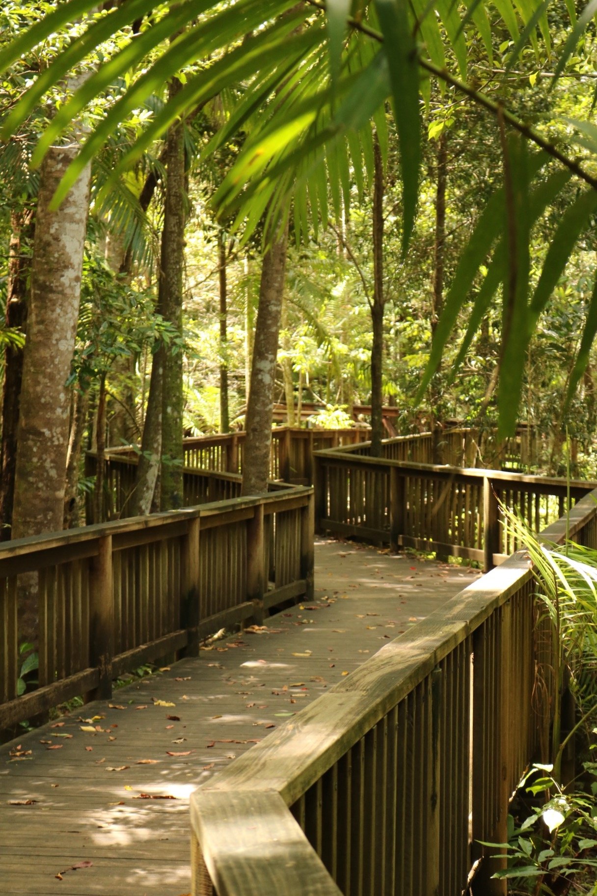
The lower entrance is at Harry’s Lane, off Lindsay Road, next to Harry’s Restaurant. It starts with an easy, raised boardwalk of about 700 m through the rainforest that suits strollers and wheelchairs. The boardwalk ends partway, and the rest of the track to the falls is not suitable for strollers or wheelchairs. Younger children can manage the crossings with care.
Quorn Close (upper entrance)
The upper entrance is at Quorn Close. A steep 350 m track with many stairs leads down to Serenity Bridge, so you need a moderate level of fitness. Plan to climb the stairs on the way back.
Both entrances have toilets, barbecues and picnic tables, and there is parking at both ends. Lindsay Road also has a large, flat, grassy area. The top entrance is under 1 km from the village cafes.
Bridge works
Sunshine Coast Council is planning to replace the Serenity Bridge pedestrian bridge. The council says the existing bridge remains safe for public use, and construction is currently expected to start from May 2027 and take about six months. Check the council’s bridge renewal page for closures before you go.
Foote Sanctuary
Foote Sanctuary is a patch of bushland on Foote Avenue, given to the community in 1948 and now about 17.5 acres. It has a picnic area with a barbecue site, tables and seating, a car park, and bush tracks.
It is a quiet alternative to the falls walk when you want shade and a picnic rather than a climb. The volunteer association that looks after it says the sanctuary supports 272 native plant species and more than 100 bird species.
Pioneer Cottage and the heritage walk
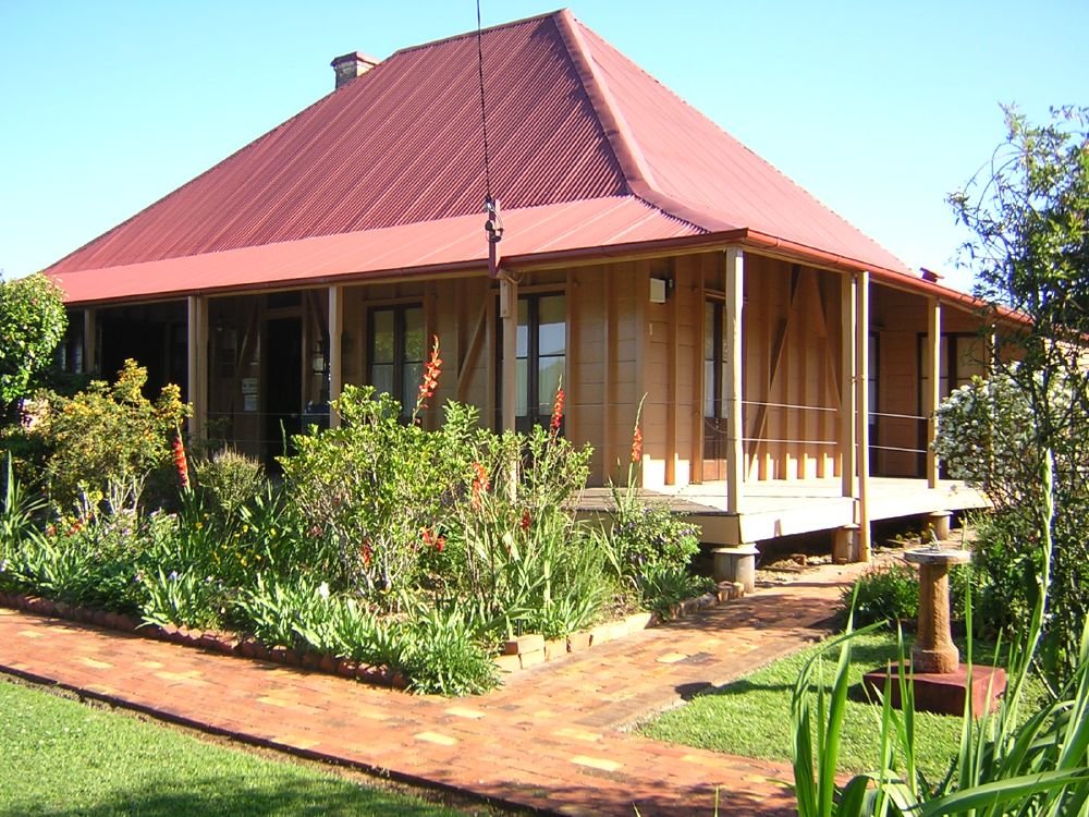
Pioneer Cottage, at 5 Pioneer Crescent, was built around 1882 and has been a museum since 1967. It is on the Queensland heritage register, and the displays cover Buderim’s sugar, coffee and ginger history.
It is open Monday from 11 am to 1 pm and Tuesday to Saturday from 11 am to 3 pm, and closed on public holidays. Entry is $5 for adults and $1 for children. There is wheelchair access, a toilet and a disabled parking area behind the cottage.
Sunshine Coast Council also publishes a self-guided Buderim Heritage Walk brochure that you can download from its heritage website. It covers the cottage and the Buderim to Palmwoods tramway, which ran from 1914 to 1935.
Ginger put Buderim on the map. The ginger factory opened here in 1942 and moved to Yandina in 1980, where you can still visit it at the Ginger Factory.
The village on Burnett Street
Burnett Street and Main Street form the village centre, with cafes, galleries and boutique shops.
Planning your visit
- How long: as little as 20 minutes to reach the falls, about 45 minutes for the loop with stops, and longer with a picnic; add 1 to 2 hours for the village and Pioneer Cottage.
- Best time: after rain for the falls, or on a hot day when the shaded rainforest is cooler than the beach.
- What to bring: shoes with grip, water and a picnic.
- Dogs: not allowed in Buderim Forest Park because it is a nature reserve.
- Accessibility: the Lindsay Road boardwalk is stroller and wheelchair friendly; the track beyond it and the Quorn Close track are not.
Getting there and parking
Buderim is about 93 km from the Brisbane CBD, about 85 minutes by car without traffic. Both Buderim Forest Park entrances have parking, at Lindsay Road and Quorn Close.
By public transport, there is no train. Kinetic bus route 617 stops at Burnett St at Buderim Marketplace, with connections to Maroochydore. Check route 617 on Translink for times.
Nearby
- Sunshine Plaza – the big shopping centre in Maroochydore, a short drive down the hill.
- Maroochydore Beach – patrolled beach and surf club at the bottom of the mountain.
- Mooloolaba Beach – swimming, the Esplanade and the spit.
- Alexandra Headland – beach, surf club and parks.
- Kawana Waters – the next suburb along the coast.
More places are on the Sunshine Coast page and in Nature walks.
You might also like
- Ginger Factory – the ginger story continues at Yandina.
- Obi Obi Boardwalk (Maleny)
- Tinchi Tamba Wetlands (Bald Hills)
Quick answers
Where is Buderim?
Buderim is on the southern Sunshine Coast, about 7 km south-west of Maroochydore and about 93 km north of Brisbane by road.
How long is the walk to Serenity Falls?
The falls loop is under 1 km, and you can reach the falls in as little as 20 minutes; allow about 45 minutes with stops. The Quorn Close entrance is a steep 350 m with many stairs.
Is Buderim Forest Park dog friendly?
No. Dogs are not allowed because the falls are in a nature reserve.
Is the Buderim waterfall walk suitable for strollers?
Only the first part. The raised boardwalk from the Lindsay Road entrance suits strollers and wheelchairs, but the rest of the track to the falls does not.
Can I get to Buderim by bus?
Yes. Kinetic route 617 stops at Buderim Marketplace on Burnett Street, but there is no train service.


0 Comments